

Features RIWA Straßenkontrolle
The roadside inspection app, based on the RIWA Web GIS roadside inspection module, is the ideal supplement for field staff to carry out roadside inspections effectively.To ensure that you can work on the spot at all times, you use the road control app in offline mode.
Your entire control cadastre created in the module and the associated control plans can be wirelessly transferred from the RIWA Web GIS to the road control app.
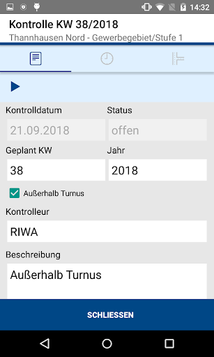
On your mobile device you can start inspection trips, record damage and measures and complete them in offline mode, both in the course of an inspection and independently of it.During a control drive, you can create all relevant data (control drive times, breaks, temperatures, weather and road conditions) quickly, easily and clearly, you can mark control sections as controlled in a user-friendly and effective way, and you can extensively document any damage and measures.Checks and check data recorded offline (including damage and measure data) as well as processing of damage and measures outside of a check drive can be synchronized with the RIWA GIS server directly in the field if there is an internet connection.
In this way, the results are available to the office staff immediately after the end of the work in the field.-------------------------------------------------- -----------THE FUNCTIONS AT A GLANCE* Offline use of road control app* Documentation of road safety* Efficient processing of pending roadside checks using digital control plans* Fast input options through pull-down menus* Automatic time stamps for control trips and breaks* Recording and localization of new damage via GPS or manually, using stored map material (e.g.
aerial photographs, open street map and field map)* Effective processing of damage and measures by displaying open and completed damage and measures per control area and control section* Clear map display of the control areas, the control sections, the created control plan, open and settled damage* Special search, filter and sort functions* Photo documentation of damage* Immediate reporting of damage via email* Parallel use of the road control app on several field service devices* Data synchronization of the data between the app and the RIWA Web GIS in online mode* Almost all display resolutions are supported by the device-independent designData can be exchanged directly between the road control app and the RIWA Web GIS if there is an internet connection.
You have the option of simply importing the control data (control areas, control plans, damage and action data) from the RIWA Web GIS to your field service device and transferring control data recorded offline directly back to the RIWA Web GIS.Almost all display resolutions are supported by a device-independent design._______________________________________Do you have any questions or are you interested in our app?
Would you like to try our road safety app with a demo ID?
Contact us directly:RIWA LtdMarketing & DistributionPhone: +49 (0)8331/9272-0Email: [email protected]: www.riwa.de
Social Features
Connect and share with friends and the community.
Gaming Features
Enjoy immersive gaming experience with various game modes.
Camera Features
Advanced camera features with editing capabilities.
See the RIWA Straßenkontrolle in Action

Get the App Today
Available for Android 8.0 and above